Carn Dearg, Monadhliath
By Tom McIntyre

Carn Dearg is one of four Munros on the Monadhliath, a vast upland plateau rising above the Badenoch town of Newtonmore. The peak forms the highest point of a spectacularly craggy ridge extending south from the main mountainous bulk. The summit can be reached via a number of ascent routes and is often combined with the Monadhliath's other three Munro summits. But one of the most enjoyable ways up is via quiet Glen Banchor and the remote pool of water that is Loch Dubh.
The start is easily reached, following the minor road from the centre of Newtonmore up past the community's church. The tarmac climbs past solid, detached houses before heading out over moor to the walkers' car park at Shepherd's Bridge.
With boots donned, follow the track west from the road end. It descends to cross Shepherd's Bridge, a solid wooden span over the Allt a'Chaorainn. The track runs level through open grazing land, passing through a gate and staying close to the River Calder initially. A derelict cottage on the left is passed before the rundown farm at Glenballoch is reached.
The track crosses the Allt Fionndrigh before skirting below the farm buildings. Continue to a high gate a few metres on. Go through this and a grassy path heads south towards the river. It runs through low woodland before turning west to reach another gate on the edge of open moor. Go through and continue to walk west through grass, heather and a profusion of wild flowers. The path meets up with the River Calder again and stays close to the water as it heads upstream.
The route crosses the Allt Ballach below the derelict cottage at Dalballoch. There is no bridge but there are plenty of well placed stepping stones and the crossing is easy. Once over the path continues to head west for around 800 metres before bearing right, following the narrow Allt an Lochain Duibh up into Gleann Lochain. The path is quite vague below the cottage at Dalballoch where it crosses quite marshy ground but it becomes much more obvious as it gains height.
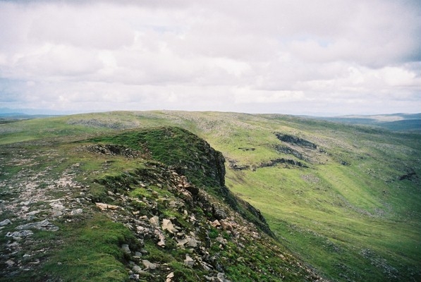
The route climbs into Coire nan Laogh, bearing right for the final section of ascent to Loch Dubh. There's an impressive wee waterfall down to the left of the path at this point. The shoreline of the lochan is reached at its southern outflow where there's a small open bothy - a grey corrugated iron shed offering basic shelter. Loch Dubh extends back towards the crags of Sron nan Laogh with its narrow waterfalls.
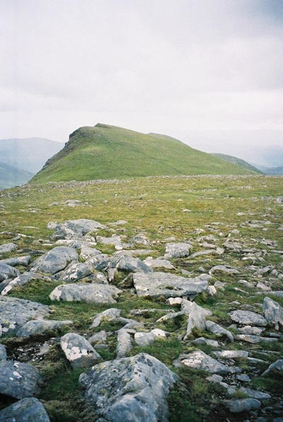
Carn Dearg (945 metres) is located to the north of the lochan and the ridge is easily seen above. There is no obvious path from the bothy, but we headed north along the east side of the loch, picking up deer tracks to reach the northern edge of Loch Dubh. From there, we followed the burn upstream before climbing over open hillside to the summit, marked by a cairn.
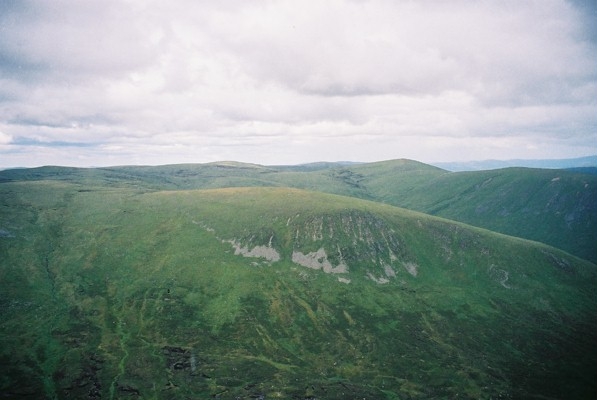
A path is picked up here and it leads north to the top of the slightly lower peak of Carn Ban (942 metres). From there, follow fence posts across the rocky plateau to the top of neighbouring Carn Balloch (920 metres). We descended over the outlying summit of Meall na Ceardaich to pick up the track running down the glen alongside the Allt Fionndrigh to rejoin the main Glen Banchor track just east of the farm at Glenballoch.
WALK FACTS
Distance 16 miles/20km.
Map OS Landranger sheet 35.
Start/parking Walkers' car park at Shepherd's Bridge, at end of minor public road from Newtonmore, grid ref NN 693997.
Grading Good track and path through open glen to Loch Dubh then over open hillside to summit.
The return is via open hillside and a good track. The estate requests dogs
are kept on the lead due to sheep grazing in Glen Banchor and there are
ground nesting birds to consider on the plateau. The gate beyond the farm at
Glenballoch has the words 'no dogs' painted on it but we ignored this
without consequence. Stalking takes place on the estate between September 20
and October 20. To assist the stalker, please phone for access permission during this time. The number is 01540 673 606.