Tolmount and Tom Buidhe
By Andrew Jarret
Take a walk with Jock and you can bag two Angus Munros in a fine high-level stroll from lovely Glen Doll. Tolmount (3143 feet) and Tom Buidhe (3140 feet) occupy part of a vast table of high land between Glen Doll in the south and Glen Callater in the north. This route begins at the popular car park near Acharn. Parking costs £1 and helps with the upkeep of the adjoining picnic area and information hut. Take the tarmac road past the farm, through a metal gate and pass below the now sadly closed youth hostel (note: at the time of writing the campsite at Glen Doll was closed also). Ignore a track which branches left across the river and continue straight on along the road through the evergreens. After about a mile or so a wooden sign points you up through the trees on a track named as Jock's Road.
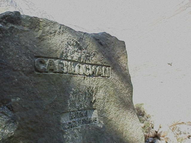
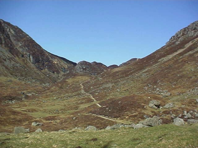
Follow this rocky road to its destination and you will eventually arrive at Braemar, some 14 miles distant. Our walk takes you roughly halfway there, to the lip of the upper corrie of Glen Callater. The track undulates through the densely packed trees and can be quite muddy after rain. Emerge at a tall metal gate and the view ahead opens dramatically as you step into Caenlochan National Nature Reserve. Keep your eyes peeled and you may be able to spot deer defying the impossibly steep crags to your right. Jock's Road winds its way up the glen, gaining height fairly modestly at first. The route narrows as the less than salubrious howff at Cairn Lunkard is approached. This rudimentary half-constructed, half-excavated shelter is likely only to appeal in an emergency but that is exactly why it was created. A cairn nearby bears a memorial to a party of five climbers who perished here on New Year's day in 1959. They had set out from Braemar but were overtaken by bad weather and succumbed to exposure as they searched in vain for sanctuary near this spot.
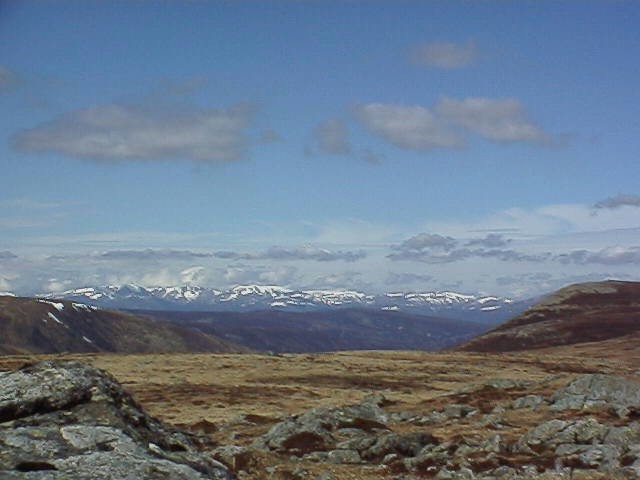
Continue past the shelter with Tom Buidhe's shoulder occupying the view to the left. Jock's Road strikes up the hillside, reaching a height of around 850 metres on a small knoll overlooking little Loch Esk. Stay with the path as it snakes up the eastern side of Crow Craigies. It tops out here at the 920 metre summit and a classic mountain vista unfolds ahead. In the far distance the snow-capped giants of the Cairngorms dominate the skyline and all around munros can be picked out. Especially prominent are Carn an t-Sagairt Mor, Cairn Bannoch, Lochnagar, Broad Cairn, Mount Keen, Driesh, Mayar, Tom Buidhe and Cairn of Claise.
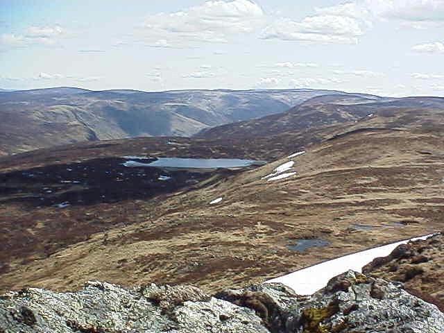
As you descend from the summit towards Glen Callater you are given a glimpse of its loch before you leave Jock's road and take to the tussocky eastern slopes of Tolmount. A large cairn among a pile of rocks marks the summit. Follow a path which bears south and follows the line of an old boundary fence, surviving now as a few rusty metal poles. Because neighbouring Tom Buidhe is basically just a lump in the plateau to the south-east, you only have to lose and regain around 100 metres in height between both hills. From Tom Buidhe, it is easy to add a third Munro to the day by continuing on to Mayar and descending back to the car park via Corrie Fee. Otherwise, just pick a line down the hillside towards Cairn Lunkard. There are a number of places where boulders placed in the glen's charming little river make crossing it a cinch. Once safely over, pick up Jock's Road again and retrace your steps back to Acharn.
WALK FACTS
Distance 13 miles/20km.
Map OS Landranger sheet 44.
Start/parking Glen Doll car park (£1 charge). GR: NO 283761.
Grading Long walk into high country where a close eye on the weather is advisable. The plateau is vast and a bit featureless so great care must be taken in poor visibility. Some parts of Jock's Road are extremely rough underfoot so stout footwear with good ankle support should be worn. Once in the upper reaches of the glen dogs can run free.