The Storr
By James Carron
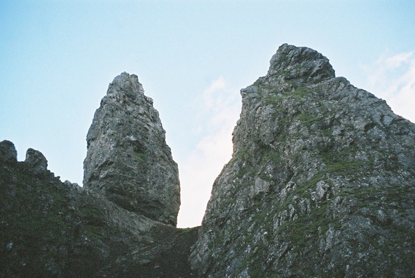
Pack plenty of film - that's the best piece of advice to take with you on this route. For the landscape is absolutely stunning and you'll find yourself clicking away on your camera every few minutes. Perhaps the most impressive feature is the Old Man of Storr, a spectacular pinnacle of rock standing proud from a landscape of shattered rock and boulders. Beside this, however, there's an equally impressive cathedral spire of stone and the giant dark buttresses forming the backdrop to this gathering of geological giants.
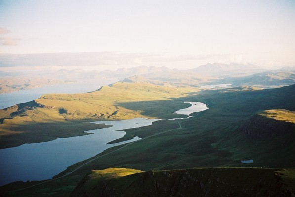
I did this walk on a sunny August evening and enjoyed pink-tinged views over Raasay to the mountains or Torridon and Applecross on the Scottish mainland.
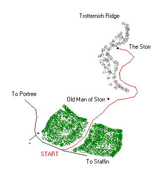
At the northern end of the car park a small 'footpath' sign points you in the right direction. The route immediately enters forestry at a set of display boards outlining the work undertaken to upgrade the path. The way climbs through the trees, emerging briefly higher up where overhead power cables cut a clearing. The ascent continues to the top of the plantation although there is a viewpoint part way up which offers a welcome breather.
A kissing gate just beyond a reedy pond marks the end of the forestry and the path continues to climb, now over open grazing land scattered with rocks and boulders and inhabited by sheep and rabbits.
The Old Man of Storr is now clearly visible above, although from this angle it is not seen in its true glory. Follow the path up into the gap between the pinnacle and a neighbouring tower of rock, to its right. Bear right, round the back of the latter, and follow the path north below high cliffs. Continue to reach a fence and stile. Cross this and the path skirts below crags, curving left to climb on to the ridge at the edge of a wide grassy coire.
The path follows the edge of the ridge, over rocky ground, and there is some easy but avoidable scrambling in places. As height is gained it skirts along the top of very high cliffs, curving round the top of some perilous gullies, narrow rocky chutes plunging straight down. Be very careful!
The path flattens out, cutting across the slope for the final section of ascent. It emerges over a lip on to a wide, gently sloping plateau of grass, a complete contrast to the rough terrain encountered below. An easy stroll takes you to the 719-metre summit where there's a stone-built trigpoint and cairn.
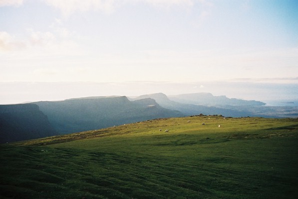
Views stretch north along the Trotternish Ridge and south over the Storr Lochs to Portree with the jagged ridge of the Black Cuillin visible beyond.
To complete the walk, retrace your steps to the car park, taking particular care when descending below the summit.
WALK FACTS
Distance 4 miles/6km.
Map OS Landranger sheet 23.
Start/parking Small public car park on A87, six miles north of Portree.
Grading Quite a demanding wee ascent to a spectacular viewpoint summit. Take great care on higher ground due to sheer drops (stay well back from the edge), and wear footwear with good grip. On upper sections of path there is loose gravel and earth. Sheep grazing beyond forest section.