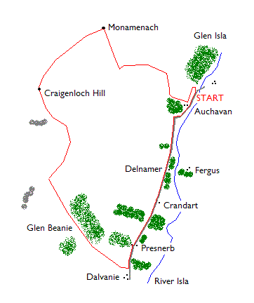
Monamenach
By James Carron
Straddling the watershed between Glen Shee and Glen Isla, Monamenach is a heathery lump of a hill. That said, however, the ascent is fairly steep, calling for a strenuous start to the route, although once the initial height is gained, a very pleasant upland wander awaits the hillwalker with some remarkable views over neighbouring peaks.
From the parking area, walk north, past the bridge on the right and, just before forestry is reached, branch left up a grassy path to reach a track. Go left and follow the track south towards Auchavan. Just before you reach a cattle grid, turn right on to a track which climbs west over open grazing land.
The ascent is strenuous. Higher up the track curves right but the arduous climb continues. The way fords a stream before bearing left, running parallel to the burn, as it rises into the wide col to the south east of Monamenach.
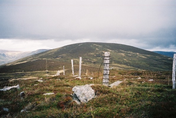
The solid estate road peters out at a junction where grassy tracks extend south, on to Creagan Caise, and north, up Monamenach. Follow the latter as it climbs on to the rounded summit, a cairn constructed at a junction of fences marking the 807 metre high point. Here there are open views north over Caenlochan Forest to neighbouring Monega Hill, Little Glas Maol and Glas Maol. To the north-west, the scree-covered eastern flank of Creag Leacach dominates the view. Look south and you£ll see the craggy northern slope of Duchray Hill and, some way beyond, Mount Blair, complete with its summit telecommunications mast.
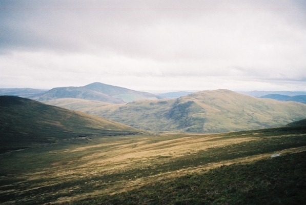
The next peak on this route is Craigenloch Hill, a mile to the south-west. A fence links the 738 metre summit with Monamenach so navigation is easy. The way descends into a peaty col and a short ascent leads to the top, the cairn located a few metres from the fence.
Stay with the fence as you leave the summit and head down into Glen Beanie. There£s a narrow path but it is indistinct in parts. In the base of the glen, the path crosses a stream and fence and virtually disappears in the grass and reeds. It£s tempting to stick close to the burn where there are traces of a route. However, a better bet is to stay slightly up on the north side of the glen where a grassy path (shown on the OS map) can be found. This improves in quality as you approach a large coniferous plantation on the left and soon joins a solid forest track. This descends to an unlocked high metal gate.
There£s another unlocked gate a little further on as the track begins to curve left to join the public road in Glen Isla, just north of Dalvanie. Unfortunately there's a further high metal gate to negotiate before you join the tarmac and this one is usually padlocked shut. The only option is to climb over and with sections of wooden fence on either side, this is easy enough. If you have a dog with you it's possible to guide your pet under the adjoining fence.
On the road, turn left and follow it back to Auchavan. The road passes through open moor and grazing land, dotted with small plantations of Scots Pine. Traffic flow is very light but take care nonetheless.
WALK FACTS
Distance 8 miles/12km.
Map OS Landranger sheet 43.
Start/parking Parking area at bridge over River Isla at GR NO 193698, just north of Auchavan, Glen Isla.
Grading A fairly strenuous route over open hills, suitable for fit adults and older children. The initial section of ascent on to Monamenach is hard work. A high locked gate must be negotiated in the latter stages of the route and this requires some agility. Dogs on the leash due to sheep grazing and ground nesting birds.