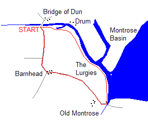
Montrose Basin
By James Carron
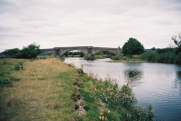
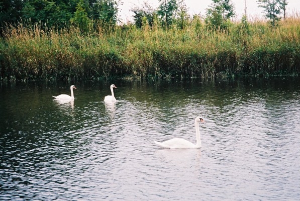
Montrose Basin is positively teeming with bird life. The 750 hectare enclosed estuary of the River South Esk provides a rich feeding ground for thousands of resident and migrant birds and has been virtually untouched by pollution or industrial development. Twice a day the tidal waters of the North Sea wash over the muddy flats, mixing with the fresh water of the river; it's a combination our feathered friends really seem to enjoy. Swans are common both on the river and in the basin and other species you should spot, in the summer, include eider ducks, curlews and oystercatches. Come autumn, flocks of migrating pink-footed and greylag geese are annual visitors. This walk follows the River South Esk downstream from historic Bridge of Dun, once the lowest crossing on the river, to the basin where the relatively narrow flow opens out into a vast expanse of gently rippling water.
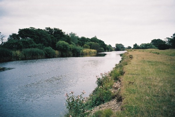
The path begins at a solid metal kissing below the southern end of the road bridge. Head east from here, along the top of the wide grassy riverbank and a good path runs alongside a fence bordering an open field to the right. It is possible at this stage to wander by the river for a short distance but you must make sure you are south of a reedy lagoon otherwise you could end up having to paddle across its outflow into the river. The path runs beneath a line of tall deciduous trees, passing through gorse, rosehip bushes and other shrubbery. A couple of cottages across the river are passed before you reach another metal kissing gate.
Go through the gate and follow a riverside path marked at intervals with wooden waymarkers. Initially cutting a course through vegetation, the way soon emerges onto the raised bank of the river, now widening out to meet Montrose Basin. Ahead, in the distance, the towering steeple in the centre of Montrose is an obvious landmark and you should be able to pick out historic House of Dun, a mansion now in the care of the National Trust for Scotland, to the north. The path skirts the edge of the basin to reach Old Montrose pier where there's another kissing gate and an information board. Head inland here. A track runs past a small car park and a sandstone cottage to reach the public road.
Turn right on the tarmac and follow the road west, passing below Old Montrose farm. The route passes through open farmland, some fields occupied by grazing cattle and ponies, others given over to crops like wheat and barley, to reach the hamlet of Barnhead.
Follow the road as it runs between houses to reach a junction, below a church now converted into a private dwelling. Turn right, leaving the tiny community behind. The road descends through farmland, crossing a bridge further on too reach another junction.
Go straight on here to reach Bridge of Dun. With the walk complete, it's worth wandering up on to the bridge where viewing platforms built into the masonry allow you to gaze east and west along the river, safe from any traffic. Railway enthusiasts may wish to continue a short distance north to Bridge of Dun Station, on the preserved Caledonian Railway which operates steam trains over its line to Brechin at weekends.
WALK FACTS
Distance 3 miles/5km.
Map OS Landranger sheet 54.
Start/parking Small layby at southern end of the Bridge of Dun, 5km/3 miles from Montrose, GR: NO 663584.
Grading Flat, low level walk on well-defined footpath and quiet country roads suitable for all. Dogs on lead at request of Scottish Wildlife Trust. Cattle grazing on part of route.