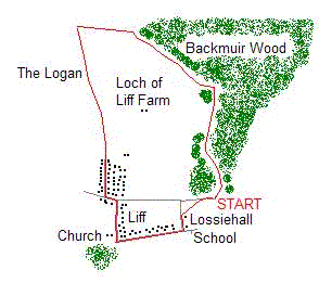
Backmuir Wood
By James Carron
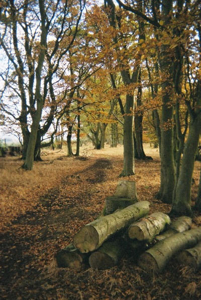
A mixed woodland containing Scots Pine, Oak, Sycamore and Silver Birch, Backmuir Wood, between Muirhead and Liff, is home to Red Squirrels, Roe Deer and Jays. It is a popular spot with local walkers and is within easy reach of Dundee.
This route combines the plantation, which is managed by the Woodland Trust, with an ancient right of way known as The Logan.
The walk begins at a wooden kissing gate in the back right-hand corner of the car park. Follow a good path north through a band of established woodland wedged between an open field occupied by ponies on the right, and a more recent community woodland on the left.
The path forks a short way on. Take the left option. A little further on a bench carved into the trunk of a fallen tree is passed. Beyond this there is a high gate on the left. Ignore this and carry straight on.
The path runs along the edge of the woodland with open fields to the left. At the top corner of the field a junction is reached. Go left here and the path crosses a grassy stretch of ground scattering with scrub before entering tall pine trees. It continues to skirt along the edge of open fields as it rises steadily, views opening out across the River Tay to the Lomond Hills of Fife. There's another bench offering welcome respite on this section.
The way climbs to the north-west tip of Backmuir Wood where there are views north to the Sidlaw Hills.
At this point leave the woodland and head west along a path hemmed in between a wall and fence. A short way on it passes through the wall and continues west. In due course the route makes a sharp left turn and heads south between two stone walls, descending between fields. You are known on The Logan track. It crosses a farm track lower down.
The path enters a playing field at the north end of Liff. Join the public road ' The Logan ' here and follow it down through a modern housing estate. At the junction at the bottom, go left and then, a short way on, turn right into Church Road. Follow the road down to the village church, where it bears sharp left and heads east, skirting between new houses on the left and a band of woodland on the right.
Continue to the road junction below the local school, which sits on the eastern edge of the village. Go left here and follow the road up to Lossie Hall. Pass the house and, at the top end of the garden, take a path on the right that skirts along the edge of a field. This rises to join the public road at the entrance to the car park.
WALK FACTS
Distance 4 miles/6km.
Map OS Landranger 53 and 54; OS Explorer 380.
Start Woodland Trust Backmuir Wood car park. Grid ref NO 340333.
Parking Free parking at the start.
Grading An easy walk with path and pavements throughout. Some sections of path can be muddy so stout footwear is a must. Backmuir Wood is very popular with dog walkers.