Tentsmuir Forest
By James Carron
A vast tract of tall Scots and Corsican pine, Tentsmuir Forest covers 1500 hectares on the north-east tip of Fife. Bounded on three sides by water - the Tay Estuary, the North Sea and the Eden Estuary - it borders the golden ribbon of Tentsmuir Sands. The area takes its name from Tents Muir, what was open moorland before the Forestry Commission began commercial harvesting here. The networks of track and path created by the foresters to allow the movement of wood are a God-send for walkers, mountain-bikers and pony trekking enthusiasts. They are even used by dog-sled teams!
The area is teeming with wildlife - roe deer, red squirrels and butterflies are among the plantation's inhabitants. Bats are also to be found here and special boxes have been put up on the tall trees to encourage growing populations of natterers, pipistrelle and brown long-eared bats. They best time to see them is at dusk when they come out to hunt airborne insects.
This route starts out from Lundin Bridge, on the eastern edge of the Fife town of Tayport. A grassy car park is provided at the start, opposite a small factory. Cross Lundin Bridge and follow a wide track running along above the shoreline, offering views across the Tay Estuary to Dundee and the Sidlaw Hills beyond. About 300 metres on, the way reaches a fork. Take the left hand one and continue below the fenced compound of a former meteorological station now lying empty. Beyond this, the track curves right to enter Tentsmuir Forest, below an old concrete war-time bunker.
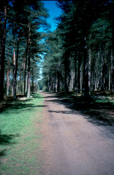
Beyond a barrier gate and just inside the plantation, the way reaches another junction. Turn left here and follow the forest road west through tall pine trees. As you go, look out for red squirrels hopping about on the trunks and high branches. It passes a couple of tracks on the right - ignore these - before entering a wide clearing. Carry on along the track and it soon disappears back into the trees. Further tracks appear on the right from time to time but ignore these and stay on the main route.
The track touches the edge of the woodland before it starts to curve south. Here there's an opportunity to poke your head out of the trees and view the estuary once again. Back on the track, follow it as its sweeps right, crossing a burn a short distance on. It emerges from the trees once again and becomes rather sandy underfoot, an indication that there's a beach not far away. Continue south until you reach the next junction.
The walk makes a short detour here. Carry straight on and you'll soon reach a 19th century icehouse on the left of the track. This was used to store salmon netted in the sea and on the opposite side of the forest road, almost obscured by trees and shrubbery, there's a small pond which provided the ice. Behind the icehouse there's a gate and stile marking the start of a track winding out to a watchtower and, just beyond the sand dunes, Tentsmuir beach. Retrace your steps from here to the junction and turn left. The track then heads west into the centre of the plantation. Ignore tracks on the left and right and carry straight on.
When the track reaches the western boundary of the forest, turn right. A wide grassy track leads north, bounded by an open field on the left. The route underfoot here is not quite as solid as the more substantial forest roads followed earlier and can be wet and muddy in places. However, it's a peaceful stretch through a mix of trees and shrubbery, lined with broom bushes.
The track curves right to reach the junction at the edge of the forest where we were earlier in the day. Leave the plantation and follow the track back to Lundin Bridge.
WALK FACTS
Distance 8.5km/5.3 miles.
Map Ordnance Survey Landranger 1:50,000 sheet 59. ;
Start/parking Lundin Bridge, Tayport (grid ref NO466279). ;
Grading Level forest circuit with tracks throughout, suitable for all.