Let Tentsmuir tempt you
By Colin Hogarth
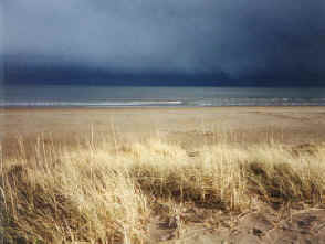
Rolling North Sea breakers crashing on to Tentsmuir Sands give way to the peace and tranquility of a woodland full of wildlife.Situated between the estuaries of the Tay and Eden rivers, Tentsmuir Forest covers 1500 hectares and was acquired by the Forestry Commission in the 1920s. Planted predominantly with Scots and Corsican Pine, it is home to roe deer, red squirrels, butterflies and a variety of birdlife. Bat boxes have also encouraged natterer's, pipistrelle and brown long-eared bats to roost.
Set out from the public car park at Kinshaldy, three miles drive from Leuchars. A wide path takes you out on to Tentsmuir Sands. Turn left and walk north up the beach. If the tide's out you may find it easier underfoot walking on the harder sand at the water's edge.
A mile on look out for an old wartime look-out post up on the dunes. Close by there is a small concrete bunker set into the ground. Take a detour to the tower and enjoy the view from the top. There's a second outpost a little further on. Out to sea you may spot grey seals and oyster catchers on the sandbanks.
As you near Tentsmuir Point, a mile beyond the second tower, climb on to the dunes and keep a post and wire fence on your left. Stay with this to a point where it turns at right angles and runs west. Over by the tree-line there are concrete blocks, a wartime effort to stop any invading tanks coming up the beach. On this walk you may also hear, and see, a more modern military presence - jets taking off from RAF Leuchars. Rather than follow the beach round the point, where channels and pools of water are obstacles, it is worth 'cutting the corner' and following the fence overland. Depending on the weather, there are patches of water to cross but these are easily negotiated. Stay with the fence until you pick up the beach again is a short distance, then head up to the north east corner of Tentsmuir Forest. Just inside the trees there's a track. Follow this west as it marches deep into the trees. In a few hundred yards a track branches off to the left - don't take this. Instead carry on until your reach the next track on the left and follow it south. There's a green post with the number '34' on it at the junction. The way stretches out in front running through patches of tall, slender pine, recently felled forest and young conifer saplings.
In a mile the track reaches a crossroad. Keep straight on, crossing the Powrie Burn. Although Tentsmuir Forest is dominated by evergreens, there are also silver birch and beech and, at ground level, a colourful patchwork of bracken, broom, lichens and heather. The track eventually emerges on to the tarmac access road to Kinshaldy car park. Turn left and, in a few yards, you are back at the start.
WALK FACTS
Distance 7 miles/11km. ;
Map OS Landranger 1:50,000 sheet 59. ;
Start/parking Kinshaldy beach car park (grid ref NO 498243). There is a parking charge. ;
Grading Level walking along sandy beach and good forest tracks suitable
for all. Swimming in the sea is not advised due to strong undercurrents and
don't venture too far out on to sand bars as they can quickly become cut off by the incoming tide.