
Clachnaben and Glen Dye
By Colin Hogarth
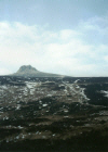
Clachnaben is an easy hill to identify from a distance. It is crowned by a prominent granite tor which can be seen from all directions as you approach.
From atop this rocky protuberance, the walker can enjoy panoramic views over the fertile agricultural lands of the Mearns, to the sea beyond, and north into Deeside and the high peaks of the Grampian mountains beyond.
A wide path rises out of the car park through a peaceful mixed woodland, a handy sign pointing the way. It descends to emerge from the trees at a rutted track less than half a mile on. Turn left and follow the way down the edge of the woodland which affords Glendye Lodge its privacy.
The route crosses a lively wee stream by way of a substantial bridge and, at a junction of tracks a few yards beyond this, turn right and the track follows the burn upstream, across the wide open plain of moorland known as Miller's Bog.
There are a few small streams to cross and bridges have very thoughtfully been provided. At another junction half a mile on from the bridge, carry straight on and the track rises gently to a gate marking the start of a small plantation of pine carpeting the lower slopes of Mount Shade.
From here, stay with the path which skirts the southern edge of the woodland and the stream remains close at hand, keeping you company as it skips down through a narrow leafy gorge. Keep your eyes peeled for deer and red squirrels.
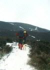
At the top of the woodland, a recently repaired path - maintained by the Clachnaben Path Trust - climbs into the col between Clachnaben, to the left, and Mount Shade. It bears left as higher ground it reached and, with height gained, superb views open out over the surrounding landscape of rolling moorland quilted with patches of forestry.
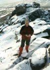
The path leads right to the summit but before it is reached, a final haul elevates you to the rocky granite tor that crowns this peak. If you fancy a grandstand view from the top of this, the scramble up over the jumble of rounded rock is easy enough, but take care as there is quite a drop on all sides.
The summit trig point is located a few yards west and a ring of stone encircling the pillar provides some handy shelter for a breather, or possibly a spot of lunch.
To continue the walk, head west along an obvious path which skirt through low peat hags to reach the top of neighbouring Hill of Edendocher, which is just a few feet lower than Clachnaben.
A cluster of high posts marks your arrival at a substantial track. Turn left and follow this south towards a prominent cairn capping the outlying shoulder. From here, the track descends towards Cairn of Finglenny and a couple more rises followed by a final descent leads to a cottage at Charr in Glen Dye below.
At the junction behind the cottage, don't cross the bridge over the Brocky Burn but head east down the valley. The track skirts round the hillside to reach a junction above a pond half a mile on. Carry straight on here and the route rises round the southern flank of Netty Hill before finally dropping to a junction. Go straight on here, walking north to rejoin the track back to the car park at the bridge near Glendye Lodge encountered on the outward leg.
WALK FACTS
Distance 10 miles. ; ;
Map OS Landranger 1:50,000 sheet 45. ;
Start/parking Small car park located 500 yards north of Glendye Lodge on the B974 Fettercairn to Banchory road (grid ref NO 649867). ;
Grading An upland hike over good paths and track to the summit of Clachnaben, returning
through Glendye. Suitable for fit walkers and older children. Stout footwear a
must and pack waterproofs and some food and drink to keep you going. A good
clear day is recommended. See also Walk 20 for an alternative, shorter, route to the summit.


