Montrose Bay
By James Carron
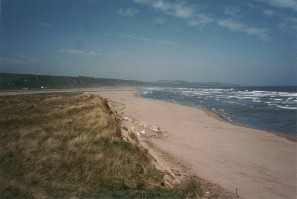
The Angus coast is a wonderful place to wander. There's so much to savour - from long strips of golden sand lurking between steep craggy headlands where seabirds roost to quiet, calm rivers meandering through leafy woodlands. The county is one of the sunniest parts of Scotland - Met Office records support this claim - and Montrose Bay is an ideal introduction to the delights that await the walker.
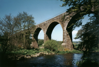
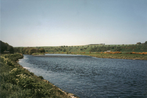
The first stretch of this route is along the town's main beach, stretching between the estuary of the River South Esk and the River North Esk. The southern flow passes through Montrose Basin, a muddy haven for wild birds, while the more direct North Esk meets the sea below the cliff top village of St Cyrus. A woody riverside path leads past quaint little fishermen's cottages to an impressive railway viaduct.
The inland path back to Montrose passes small copses of woodland, offering a completely different perspective, away from the often bracing coastal breeze. And for those interested in history, the final stretch makes use of old taxiways connected with a former wartime airfield where an aviation museum has been established.
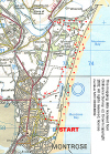
Leave the car park at South Links, Montrose, and head across the road and out on to the beach. The sand extends north, backed by high grassy dunes. Walk north along the beach until you reach the mouth of the River North Esk where huge flocks of seabirds are often to be seen resting on sandbanks.
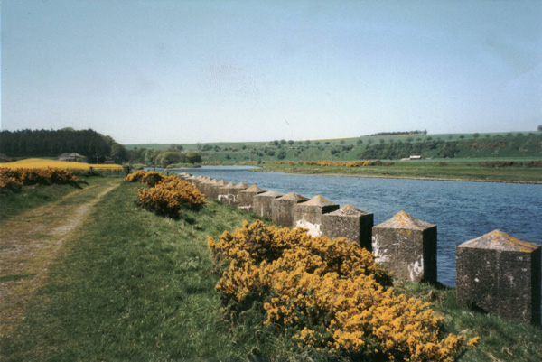
As you approach the mouth of the river, the dunes on the left start to lower in height. Leave the beach and climb up over them, then descend towards the south bank of the river. A short way inland a track is joined and this runs west, crossing a small wooden bridge over an off-shoot of the river. This continues to reach the corner of a woodland where you pass through a gate. The way runs parallel to the river, passing a compound of rusty old tanks and a cottage.
The roadway arrives at a small fisherman's bothy on the right. Continue along the riverbank, passing a collection of old wooden fishing boats now sitting high and dry. The way skirts through tall deciduous trees, to make the short detour to the disused railway viaduct, which is well worth a quick visit. From here return to the bothy and turn right, following the road past Fisherhills. At the next junction turn left and a track leads east back towards the sea. It skirts between two coniferous plantations to reach a junction just short of a salmon station.
Turn right here and follow the track to the edge of woodland on the left. It is possible to continue straight on along the track here but a more pleasant option is to bear left and follow the fence along the edge of the trees towards the dunes. At the bottom corner of the trees, turn left and walk south between the plantation and the dunes. At the end of a long clearing, you pass by buildings. Continue straight on along the edge of the woodland and, at the end, turn right, a sandy path leading down to a stile in the corner of the fence.
Cross the stile and walk over a piece of rough ground to reach a substantial concrete track. ; This formed one of the taxiways of the wartime airfield. Follow the track south, skirting along the edge of a golf course. Periodically you will pass solid concrete bunkers on the left. These offered shelter in the event of airborne raids on the military target but most are now filled with rubbish. A mile on you pass by a golf driving range and, beyond a pair of gates, the track curves gently right. At the next junction, turn left and the public road is joined just beyond a civic amenity site.
Turn left into Broomfield Road. Beyond a set of bollards at the far end, head left on a tarmac path occupying the trackbed of an old railway. This runs by a paddling pool and play park to reach the golf course clubhouse. Join the public road in front of this, turn left and follow the road back to the car park.
WALK FACTS
Distance 7.5 miles/12km. ;
Map OS Landranger 1:50,000 sheets 45 and 54. ;
Start/parking South Links, Montrose (grid ref NO 727580). Plenty of free parking. ;
Grading Easy, flat route along sandy beach, track and path.