Cairns and cliffs
By James Carron
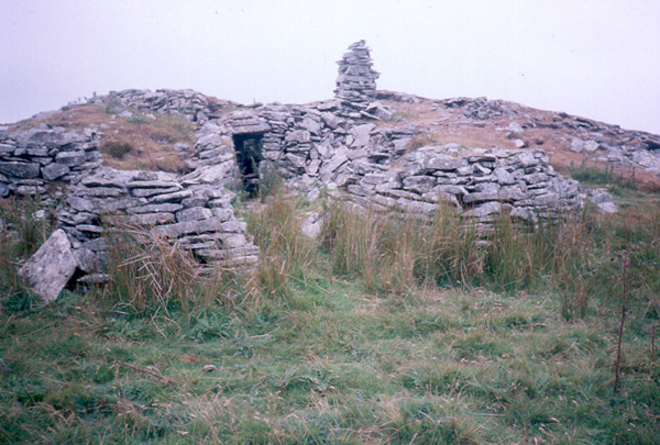
Venture on to the heather covered slopes of Hill of Yarrows and you'll find a land littered with archaeological sites. There are more than 80 known locations of interest here, ranging from simple burial cairns to more extensive forts.
Many are well preserved and provide evidence of occupation dating back thousands of years. Our route takes in several sites and on the return leg, you can explore the Whaligoe Steps, a flight of 365 steps leading down to a small harbour. The story goes that for years they were maintained by a local lady who was convinced that God, as a fisherman, would arrive at Whaligoe by sea and she wanted to be ready for him.
From the parking area at the south end of Loch Watenan, head back along the minor road a few yards towards Whaligoe to Historic Scotland signs for Cairn o'Gets and Garrywhin. Cross a stile and take the path north over an open field, following a line of black and white marker posts.
At the other side of the field, cross another stile and head up across open hillside. The path runs across heather moorland, crossing a boardwalk at one point, to reach the first of a series of chambered burial cairns. This one has an information board outlining something of the history of the area.
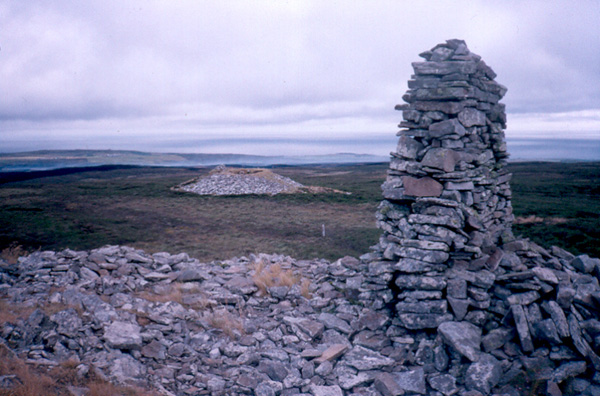
From here, head west over a mossy dip on to Warehouse Hill. There is a vague path but you may end up making your own way through bracken and then heather onto the low top. Continue north to the next very prominent summit, marked by three large cairns. Again, there is no path and battle must be done with the heather.
The remnants of further burial cairns reward the climb and Hill of Yarrows can be seen in the distance. To reach it, head east over the open hillside, skirting round the west end of Loch Warehouse before the final short stretch of ascent to the trig point.
The summit of Hill of Yarrow is an excellent viewpoint with panoramas out over the North Sea. Oilrigs are just visible on the horizon.
Descend north-east to pick up a track north of South Yarrows farm and walk along with is to the end of the minor road (grid ref 303443). Follow the quiet single-track roadway, dotted with small cottages and steadings, east round the northern edge of Loch of Yarrows, part of the public water supply for Wick. Stay on the road until you reach a crossroads and turn right here, following the road into Gansclet. When you reach the A9, turn left and follow it the short distance into the neighbouring community of Thrumster.
In Thrumster, turn right and follow a minor road east, past the Smiddy Inn on the left and the primary school on the right. When it splits, take the right fork, which curves south, running above Loch Sarclet to Mains of Ulbster Farm. Carry on past the farm, then head south-east overland towards the Stack of Ulbster. From there, turn south and walk along the top of the cliffs down to Whaligoe. Emerge on to the A9 and follow the minor road opposite the telephone box back to the car park.
WALK FACTS
Distance 9 miles/14.5km.
Map OS Landranger 1:50,000 sheet 12.
Start/parking There is a small area of public car parking at the south end of Loch Watenan. To
reach this, once in Whaligoe (seven miles south of Wick on A9), turn off
the A9 opposite BT telephone box on minor road signed Cairn o'Get, grid ref ND 318408.
Grading This route sets out over initially rough heather moorland, often without
obvious path where the walking can be hard work. The rest of the route is over quiet country roads and along coastal cliffs.