

Looking for Lochay
By Colin Hogarth
Enjoy a seven mile leg stretch through one of Perthshire's most delightful and remote glens.
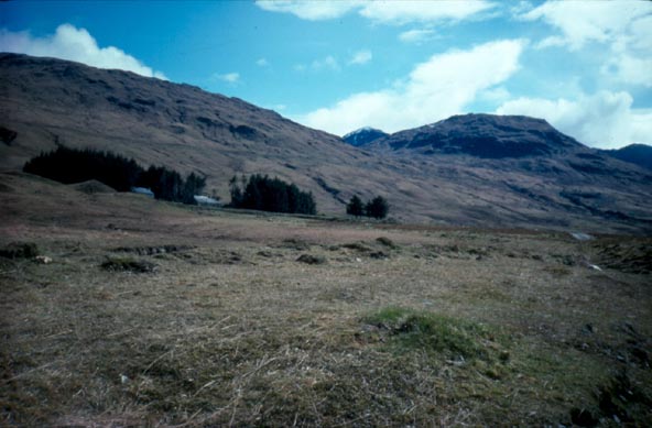
The public road through Glen Lochay from Killin ends a short way beyond Kenknock Farm, at a bridge over the Innisraineach Burn. The walk starts here and heads west across the bridge to a gate. On the far side the track sets out through open land, crossing a large pipeline a short way on. This is part of the extensive local hydro-electric network, much of which is buried under the ground and goes largely unseen.
The track follows the River Lochay upstream and, a mile on, it forks. The left arm drops down to cross the river before climbing to the lonely farm cottage at Lubchurran on the hillside above. It provides access to two Munros - Beinn Cheathaich and Sgiath Chuil. Both can either be tackled from Glen Lochay or Glen Dochart, to the south. The glen walk provides a good view to both and may whet your appetite for a future expedition.
Don't take this track today, but go right and the way rises gently, passing a shed before dropping to continue over grazing land. As you progress there are several small burns - some with bridges - to cross. Thankfully none of those without bridges provide any real obstacle and you should escape dry-shod.
The river below, where these wee watercourses ultimately end their bubbly youthful enthusiasm, continues to remain close at hand as the track skirts by a small woodland before crossing the Allt Badour via a more substantial bridge below cottages at Badour.
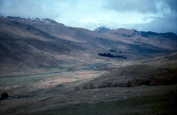
Beyond this is Batavaime farm, the last occupied building in Glen Lochay. There are the ruins of cottages higher up the valley, but these have long since been vacated. The track fords the Allt Batavaim here and, a short distance on, reaches a junction.
Turn right and follow the track up the slope as it zig-zags steeply before flattening off at the top. Above are the rugged flanks of another Munro, Beinn Heasgarnich, and this is where those heading for its summit leave the track and set off up a narrow path.
To continue this walk, however, turn right and the track leads to a bridge over the Allt Batavaim. There's a gate just before the bridge and, once across, the way strikes east, following a track built to service a pipeline running below ground here.
Although this track runs parallel to the outward route in the base of the glen, the raised elevation offers a different perspective on the glen and there are some marvellous views to enjoy as you wander east.
The track negotiates a couple more gates before arriving at a concrete bridge over the Innisraineach Burn, located at the top of the pipeline passed earlier in the day. A few yards on the way meets a single track road. Turn right and follow this down to the start.
WALK FACTS
Distance 7 miles/11km.
Map OS Landranger 1:50,000 sheet 51.
Start End of Glen Lochay public road, a short way beyond Kenknock Farm (grid ref NN 465364).
Parking Spaces at the start.
Grading Good track walk suitable for all abilities. Stout waterproof footwear recommended.
The walk runs through cattle and sheep grazing land, so dogs must be on the lead.

![]()