A walk to fall for
By James Carron
Choose a good forest walk in Scotland and you'll find more than just trees. The waymarked Forestry Commission route through Carrick Woodlands to the Falls of Stinchar is a fine example. A quiet path negotiates the trees, leading to an impressive waterfall hidden deep within the heart of the forest.
Along the way, pink foxgloves and a profusion of bluebells inject colour into what is one of the largest and most diverse forests in southern Scotland. Ideal for all ages and abilities, the shelter of the trees makes this a walk for that day when the weather is not quite so good.
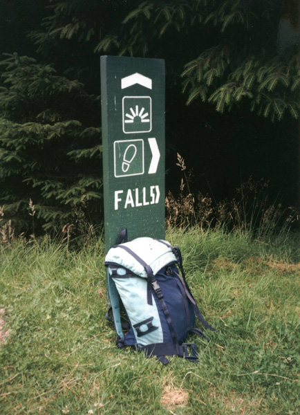
The starting point for this route is the Forestry Commission car park at Stinchar Bridge, on the Straiton to Bargrennan road. From here, follow the access track back down to the road, emerging next to the bridge. Cross over the tarmac and a path heads west to the right of the burn, passing a signpost for Stinchar Falls. The path and burn run parallel through a ride in the dense woodland, crossing several rather springy boardwalks along the way.
Beyond a small dam, the path reaches a wide forest track. Turn left and follow another sign for Stinchar Falls. The track skirts through the trees to emerge above a large felled area where the clearing offers excellent views north and west over woodland and low hills.
Further on, the track known as the Aqueduct Road, due to a large underground water pipe running on its north side, reaches a green sign pointing to the falls. A steep path of scattered pine needles descends to a viewpoint above the falls.
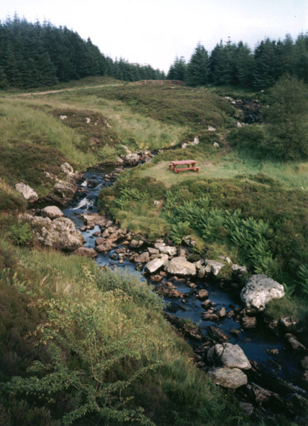
They are a modest affair normally but, following a spell of rain, the water cascades through a series of small waterfalls linked by a chain of deep pools cut into the rugged rock.
From the viewpoint, a path bears left through the trees and shrubs, eventually widening into a grassy track. Stay on this until a waymarker on the left indicates the start of a short detour into the forest, returning to the track along the riverbank.
The path joins the track by a concrete bridge over the River Stinchar. Cross it and, beyond a couple of picnic tables below a small waterfall, a path leaves the track on the right and follows the burn through the trees. It arrives at the junction below the dam encountered earlier in the day. Retrace your steps to Stinchar Bridge from here.
WALK FACTS
Distance 5 miles/8km.
Map OS Landranger 1:50,000 sheet 77.
Start/parking Forestry Commission car park at Stinchar Bridge (grid ref NX 395946).
Grading An easy, low level forest walk with path and track throughout. Underfoot conditions can be muddy in places.