Along the Angus coast
By Colin Hogarth
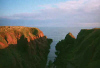
The cliff trail north of Arbroath is awash with fascinating rock formations, christened with such evocative at the Deil's Heid, Seaman's Grave and Mermaid's Kirk. It's a bracing coastal walk skirting the swirling sea that can be enjoyed at any time of the year.
In the culinary world, Arbroath is best known for its smokies, a smoked haddock dish which originated in the nearby village of Auchmithie. These are available from local fish merchants and can be eaten cold straight from the wrapper. The best way to eat a smokie is to peel back the skin, eat one side of the fish, then carefully pull out the spine and all of the bones should come with it, allowing you to enjoy the other side.
The walk starts at the east end of Victoria Park, next to the public toilets at Whiting Ness. A tarmac path leaves the park at an information board and climbs above the red sandstone cliffs. It levels out quickly and skirts between open fields on the left and the sea to the right. The path is not far from the edge, so take care. You pass through Seaton Cliffs Wildlife Reserve here. This is home to a range of seabirds including fulmars and herring gulls plus an array of wildflowers and butterflies.
About half a mile from the start is the Needle E'e (Needle's Eye), a rock with a narrow hole cut through it. The path curves left a short way on to loop round above Dickmont's Den, a deep, narrow inlet where the sea bubbles and froths below. Continue round the channel and the path is reunited with the clifftop.
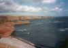
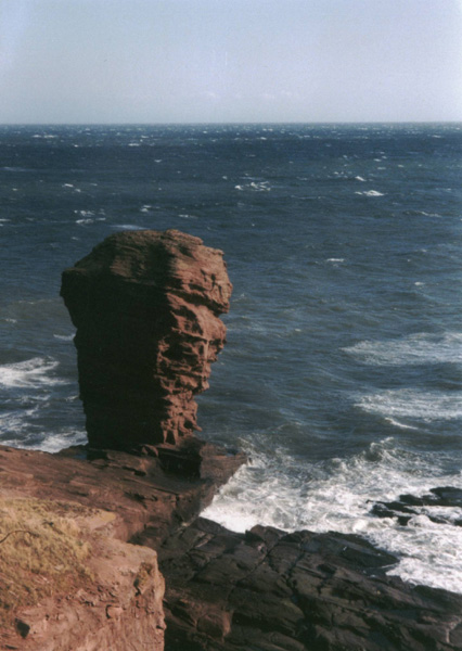
Further on you can't miss the Deil's Heid (Devil's Head), an impressive sea stack. The path curves left round the headland here and in half a mile it reaches Carlingheugh Bay, known locally as The Flairs. On the right a small path drops down to the pebble beach. The route continues straight on here, but the short detour is well worth making.
There is a sea arch at the south end of the shoreline and a couple of caves to explore at the north end. This is a fine spot for a picnic. Back on the clifftop path, the way heads inland, leaving the sea behind, and continuing into the woods of Seaton Den.
The way drops to cross a small stream then rises gently through the peaceful glade, a mix of deciduous trees, broom and gorse.
At the top you emerge on to a quiet country road. Turn left and follow the road round the edge of a field to its next junction. Go left again and stay with the road for a half a mile as it skirts along the side of a strip of woodland until you reach a track on the left, signed for Seaton Estates. Turn left and follow the track down past Seaton Estate Caravan Park. The site entrance is on the right a short way down. Don't go in but carry on straight ahead until you reach the farm at East Seaton at the bottom of the track.
When you reach East Seaton, turn right and then left a few yards on. A wide track heads seaward, following the farmhouse garden wall down past a small cottage. Carry straight on through a metal barrier gate and the track passes between open field to rejoin the coastal path. Turn right and retrace your steps along the nature trail to Victoria Park.
WALK FACTS
Distance 4 miles/6.5km. ;
Map OS Landranger sheet 54. ;
Start/parking Whiting Ness, Victoria Park. GR: NO 658412. ;
Grading An easy, level walk which can be enjoyed by all ages at all times of the year but take great care along the cliffs.
Accommodation Brucefield House, Arbroath.