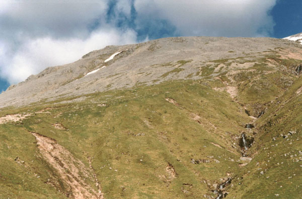
North face of the Ben
By James Carron
At 4406 feet, Ben Nevis is the highest mountain in the British Isles. The ascent starts from almost sea level and is hard work, even for the fit walker. Although this route does not take in the summit, it does climb up over the west shoulder of the mountain before skirting round below the north face, arguably the most impressive aspect of the Ben.
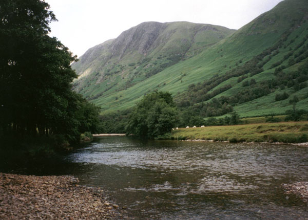
The walk starts at the Ben Nevis Visitor Centre in Glen Nevis where a footbridge at the back of the car park crosses the River Nevis. On the far side, the path turns right and follows the river upstream for a way. Then, just beyond Auchintee bunkhouse, it turns left, crossing a stile.
The first short burst of climbing brings you out above Auchintee House where the path crosses another stile and then rises over the open hillside. The ascent is well graded but hard work. The path here has been built to cope with the thousands of pairs of feet that trample over it each year so, although a little eroded in places, it is fairly solid.
Just under a mile on, the route is joined by a path up from Glen Nevis youth hostel. From the junction, the way rises more steeply, doubling back on itself as height is gained. Another switchback and a steady climb takes you to the col between Ben Nevis and Meall an t-Suidhe. Lochan Meall an t-Suidhe occupies the hollow here.
Continue on the path up to the start of the next switchback. At the junction here, leave the Ben Nevis ascent path which goes up to the right and, instead, turn left and head north, skirting round to the next glen. The path drops and you pass below the dramatic north face of the mountain where huge cliffs - popular with climbers - tower overhead.
The path skirts along the hillside to reach the CIC hut, a locked climbing hut used by members of the Scottish Mountaineering Club. Behind it is the Carn Mor Dearg Arete, a narrow ridge between Ben Nevis and its neighbour, Carn Mor Dearg. From the hut, take the path down the glen, following the Allt a'Mhuilinn.
Stick with the burn and, two miles on, the path joins a track. Cross the stile here and follow the track down a short way to a three-way junction. Go left and descend past a dam to a bridge over the burn. Head west along a good track. Down to the left is the sprawling British Alcan aluminium smelter.
The track drops to a junction. Turn right here and descend steeply to the bottom of the hillside, where the track meets another track running parallel with an electricity pylon line. Follow this west towards the aluminium works and, after it crosses a small burn, take a footpath branching off to the right with a sign pointing to the main road.
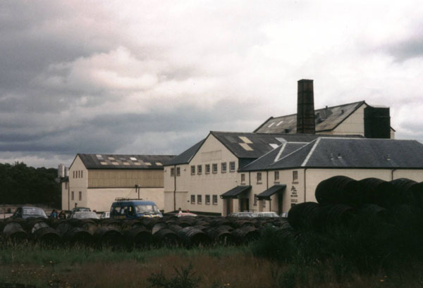
The path passes below the railway line, skirts round behind the bonded warehouses of the Ben Nevis Distillery and emerges on to the A82 road. Turn left and head into town. A mile on, cross the Nevis Bridge and, at the roundabout just beyond, turn left and follow the road up Glen Nevis to the visitor centre.
WALK FACTS
Distance10 miles/16km.
Map OS
Landranger 1:50,000 sheet 41 or Harveys Ben Nevis.
Start/parking Ben Nevis
Visitor Centre, Glen Nevis, near Fort William (grid ref 123730).
Grading A long
walk up and over the southern flank of Ben Nevis suitable for fit hillwalkers.
Good paths and tracks throughout.