Out and about in the Ochils
By Archie Martin and Andy Crawford
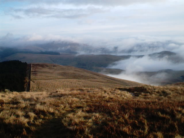
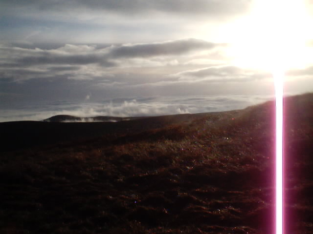
The Ochils are a Mecca for hill-walking enthusiasts, but on the cold and damp January morning we did this particular walk, we didn't see another soul. Dense fog shrouded the valleys below, but the sunshine above took our minds off the freezing temperature which persisted all day.
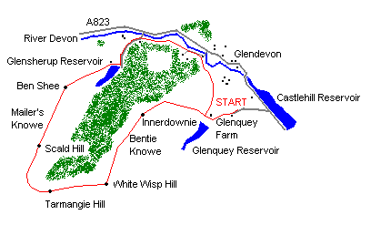
Leave the A823 opposite Castlehill Reservoir and follow the East of Scotland Water access road up to the Glendevon AA Fishermen's Car Park - a flat, grassy area on the right just before a cottage.
The walk begins along the tarmac road forking right hand towards Glenquey Farm. Do not enter the farm confines, but bear left on the wide, rough road to a gate with a stile to its left. A few metres past this, turn right onto a Land Rover track up the grassy hillside through where the Woodland Trust are planting a forest of deciduous trees. Where this track bears sharp left, go right, to the wall, and continue all the way to the top of the rise where it meets the boundary wall (and fence) of the well-established Forestry Commission plantation.
Turn left here and follow the tracks alongside the wall, in a south-westerly direction, on a gradual ascent to the cairned top of Innerdownie. After a further 1.5 km (958022), pass through a gate in the new deer fence and ascend gently to a junction of fence-lines to the north of the summit of White Wisp Hill, at the County Boundary Line. Tracks on either side of the fence and wall lead over the summit of Tarmangie Hill and down to another fence crossing.
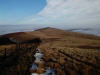
Follow the Land Rover track, ahead, as it sweeps north-easterly towards, and past, Scad Hill then down an easy shoulder over Mailer's Knowe. Take a few minutes here to absorb the spectacular vista of the surrounding countryside and the distant Grampian mountains.
A wall crosses the path at the saddle below Ben Shee and two gates offer alternative access to the next part of the walk. To go over Ben Shee, go through the right-hand gate and keep the fence on the left. Alternatively, take either gate but keep the fence on the right. Follow the sweep of the fence, regardless of the chosen route, as it drops down the grassy slope to the dam at the north end of Glensherup Reservoir.
Cross the dam and take the short, steep path up onto the wide forest road, below Black Hill. This road offers the opportunity to stretch the legs on terra firma after the ankle-wrenching tussocks of the hill tracks as it descends through the mature pine forest. Pass through the gate at Whittens Cottage then bear left on the wide track down to the banks of the River Devon and the A823.
Do not cross the river, but pass through the gate on the right of the track and follow the narrow path on past a wide grassy area - used as a caravan and campsite during the summer months. A short, sharp rise ends this track where it meets the driveway to Glendevon House. Turn left here and walk on past 'The Lodge', under an impressive stone archway to a bridge over the river. Take the track on the right, keeping the river on the left.
More new deer fencing has been erected here to protect the new saplings. Continue along the wide Land Rover track - with the fence on the right - for approximately 250 metres. Pass through a gate in the fence and take the uphill track, which offers fine views of the surrounding area and the hamlet of Burnfoot.
This track leads back to Glenquey Farm. Approaching the farm, a signpost directs walkers to the north-northwest, out to where the first gate and stile of the walk was encountered. Cross the stile, turn left and walk back to the starting point.
WALK FACTS
Distance 10.6 miles/17 km.
Map OS Landranger, sheet 58.
Start Glendevon A A Fishermen's Car Park (grid ref NN 989035).
Parking The car park is reached from the A823, turn-off on the west side of the road onto the East of Scotland Water access road.
Grading A strenuous hike over (or around) the summits of five tops in the Ochils. Sheep grazing means dogs should be on the lead.