Moorfoot Hills
By Andy Crawford
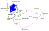
The Moorfoot Hills lie southeast of Penicuik in Lothian Region, and are within easy reach of Edinburgh. Like the Pentland Hills to the northwest, these hills offer rolling open country detached from the hustle and bustle of Scotland's capital city. Although low by comparison to other Scottish hill ranges, the Moorfoot Hills form a pleasant walking ridge of little tops no higher than 651 metres (2136 feet). The highest of the hills, Blackhope Scar, is at the outer edge of this circuit starting from Gladhouse Reservoir. It is classed as a 'Marilyn'.
From either of the two small car parks situated a short distance apart at the northeast end of Gladhouse Reservoir - a fresh water supply source for the Edinburgh district - turn right and follow the minor road east then south, around a spur of the reservoir, to Mauldslie Farm. Near the farm is a wooden five-bar gate leading into a field. Continue through the gate, on the Land Rover track, passing through a strip of trees before descending to another gate. Once through this gate you are onto open hillside.
Disregard the finger post, a few yards to the right of the gate near the farm at this time. It indicates a footpath but relates to the return section of this walk.
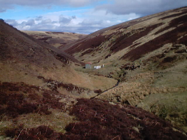
There are two, small stands of trees which should be kept to the left as the route continues up a gentle rise to just short of a fence line. Turn right here, up a green path and through some bracken left onto a wider track then bearing right to a gate at the low bealach between Torphichen Hill (460m/1509 ft) and Mauldslie Hill (513m/1683 ft). From the gate, follow the path that goes straight ahead and down the gentle slope to where a tall, grey slate roofed timber barn stands at the junction with a rough road from the nearby B7007 to Blackhope Farm. Follow this 2km/1.25 mile road to the right, into a steep sided glen alongside Blackhope Water and past the farm. Near the end of the road is a deep ford which can be avoided by bearing off to the right on a narrow path which leads up to a bridge near the first of the two small, arch roofed, corrugated iron barns that offers some shelter for a much needed break!
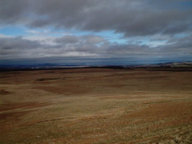
A wide green path leads from here to the head of the glen. Past the second barn at the confluence of the two burns, cross over the small footbridge and head southwest up the short, steep slope on a narrow, almost straight line path that maintains the ascent beside - and sometimes through - the heather to the left side of the shoulder and up to the trig point on the broad summit of Blackhope Scar. The final steps of this ascent feel quite steep when compared with the route so far but the panorama, viewed from such a 'wee' hill, is quite impressive.
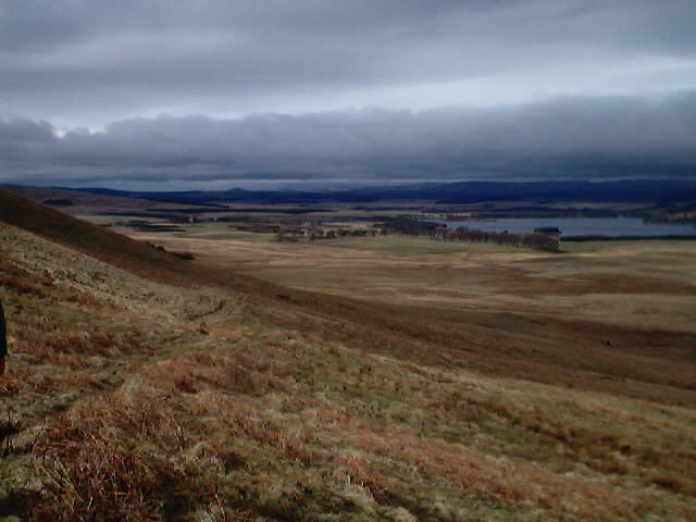
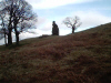
The path swings northwest. Follow the faint narrow track along the county/regional boundary fence line before negotiating the fence, taking care not to cause any damage, then walk due west over the tussocky grass for a short distance onto the wide track leading down beside 'The Kipps'. It is possible to cross this fence at any point after the grouse butts, but there is no path down the steep slope that is pitted with lots of hidden and potentially leg or ankle breaking potholes. At the foot of the descent turn right - north - on the rough road beside the River South Esk, from where, directly ahead, Arthur's Seat in Edinburgh is visible and a short distance on, the southern aspect of the Pentlands comes into view to the left. The remains of one wall of the ruined Hirendean Castle 'pops up' on the right hand horizon a short way before Gladhouse Cottage.
It is easy walking from here through Moorfoot Farm and past Huntly Cot from where the footpath is very clearly indicated all the way back to Mauldslie Farm. The remainder of the walk is a back-track along the tarmac road to the starting point.
WALK FACTS
Distance 12.5 miles/20km.
Map OS Landranger sheet 73.
Start/parking Car Park at Gladhouse Reservoir, one mile to the east of the B6372. GR: NT 305543.
Grading Mostly good paths, but rough over the higher hillside. Some steep ascents and some sections on minor roads. Suitable for fit hillwalkers. Since dogs are NOT allowed between Huntly Cot and Mauldslie Farm it is best they are not taken on this walk.