St Cyrus Sands
By James Carron
The St Cyrus National Nature Reserve, wedged between Montrose Bay and high, rocky cliffs, offers a rich and varied habitat for birds and animals. It includes sand dunes, heathland, foreshore and saltmarsh and is home to healthy populations of whinchats, fulmars and oystercatchers while salmon frequent the coastal waters.
The bird breeding season runs from the start of April through to the beginning of August and this, combined with a gloriously unspoilt sandy beach which should appeal to all sun worshippers, makes summer the perfect time to a visit.
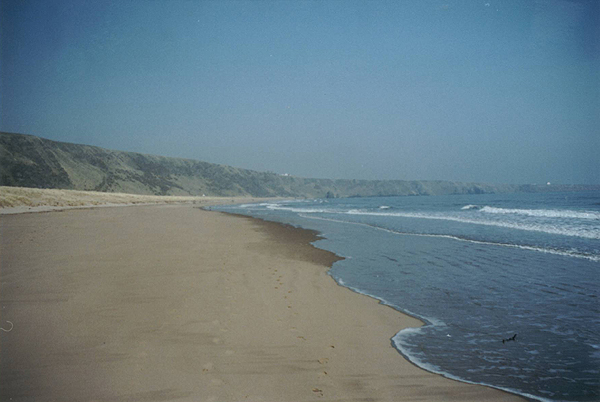
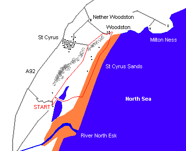
From the car park entrance, cross the minor road to join a path at an information board. Turn left and follow the way along the edge of a high fence bordering a B&B to a long wooden boardwalk and bridge crossing the saltmarsh. Cross and at the far end of the bridge, the boardwalk climbs gently to the top of the sand dunes. Drop down to the beach on the other side, turn left and follow the sand north-east. The hard sand by the water's edge makes for the easiest walking and paddling is a tempting possibility in the summer.
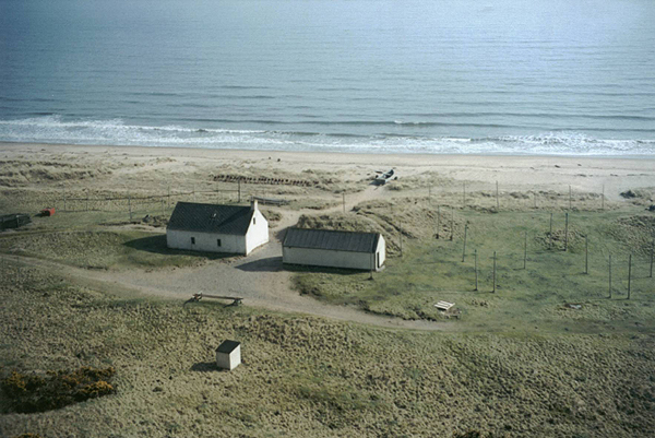
As the beach approaches its northern end, the golden sand is dotted with large outcrops of dark rock. Wander through the first of these and before a rocky headland juts out across the beach, pick up a wide path that climbs to the top of the top of the cliffs. It curves left higher up to reach another information board on the right. Continue to bear left, join a surfaced road and walk through the cluster of buildings at Woodston Fishing Station, now a B&B.
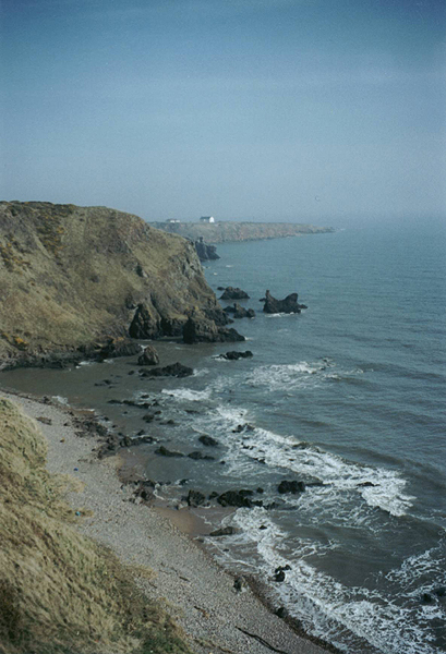
Walk round a chain barrier across the roadway and turn left, a wide grassy path rising gently to a small public car park below St Cyrus, the spire of the village kirk visible across the open field on your right as you approach. From the car park, there are excellent views south over St Cyrus Sands and Montrose Bay towards the wide estuary of the River North Esk.
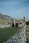
At the car park, a cliff path on the left, constructed in the 1880s, descends at a steady gradient to the grassy nature reserve below. Carry straight on when a junction is reached midway down (following a white arrow on a post) and the way levels out behind a pair of white cottages, a salmon fishing station, where tall poles are used to dry nets. Pass through gorse bushes and turn right on a grassy track heading south-west below the towering cliffs on the right.
The way runs level through open scrubland to the walled cemetery at Nether Kirkyard. Beyond this, a gate is reached and from here a good track runs on past the B&B encountered at the start of the walk to join the public road. Turn left and follow the road the short distance back to the car park.
WALK FACTS
Distance 3 miles/5km.
Map OS Landranger sheet 45.
Start/parking St Cyrus National Nature Reserve visitor centre car park. GR: NO 742634.
Grading Sandy beach and low-level tracks and paths. Suitable for all, but keep dogs on lead, except on beach section.