In the footsteps of Bonnie Prince Charli
by Andy Crawford
The Sma' Glen flourishes with all the picturesque beauty and legend of the Scottish Highlands in a scaled down form. Above the floor of the narrow valley, barely wide enough in places for the road and the fast-flowing River Almond, the scree, rock and heather-covered slopes of Dun More and Meall Tarsuinn tower high on either side.
Throughout the route, all that remains of the crofting families who once inhabited the area, but are now long gone due to the Highland Clearances, are some tumble-down walls, moss-covered foundations and a few marks in the fields. A potted history of this fascinating area can be found at here.
Close to the southeast side of Newton Bridge in the Sma' Glen, where the A822 crosses the River Almond is a lay-by (sadly no longer equipped with its picnic tables and public conveniences) which is the starting point for this walk.
Cross the sturdy Newton Bridge and walk north - remembering to stay on the right-hand side of the road as you go to face the oncoming traffic. After 600 yards, cross the road, pass through a gate on the left then over a tiny stone bridge. The first part of the walk, to Amulree, is a remnant of the English General Wade's road built in 1730 for the sole purpose of moving troops to crush the rebellious Scottish clans and, ironically, the route taken by Bonnie Prince Charlie as he marched north to the now infamous massacre at Culloden (1746).
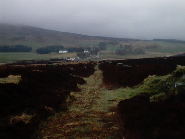
Turn right off the bridge and follow the line of the old military road, relatively easily identified by its directness and raised areas flanking each side. In places it is a bit boggy underfoot but firmer paths exist along the raised areas. Near Corrymuckloch, the old and new roads merge so stay inside the fence-line and continue towards the west side of the small stand of trees beside the farm. Negotiate the two gates at the outer edge of the farm - one ahead then one immediately left - onto a wide, divided track. Take the right-hand fork, heading towards a gate beside a low communications mast, from where the line of the old road again becomes obvious as it rises gently ahead. A wall and fence have been built across the path but these are easily crossed - taking care not to damage either. On the descent to Amulree Hall, the heather is kept well trimmed to maintain the line of the old road and facilitate access to the shooting butts.
The shorter route option from here is to turn left and walk some two and a half miles along the road to Croftmill.
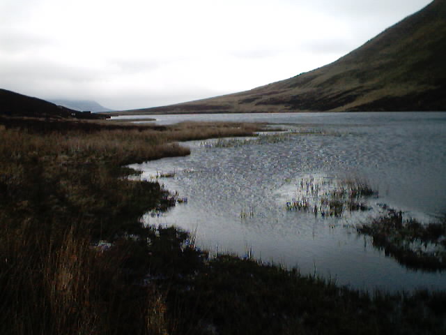
For the full round, continue up the main road past the Amulree Hotel to the sharp right-hand bend and take the undesignated road leading westwards past Lochan Lodge and Wester Kinloch farm. After the farm, the track continues up a gentle rise through a deciduous wood along the northeast bank of Loch Freuchie ending at Turreich on the flats at the head of the loch. Walk up to the minor Amulree to Kenmore road, turn left and walk along the road for approximately a mile to Croftmill where a rough, wide, private road leads southwest past a stone cottage and rises gently over open moorland to Lochan a' Mhullin. Where the track passes the lochan, it is quite wet and boggy, but improves as it continues into the glen. Cross the little burn before reaching Lochan Uaine (the green lochan), now almost completely in-filled by reeds, and follow the narrow, winding path through the heather, below the seemingly almost vertical flanks of Beinn na Gainimh and Meall nam Ruaran, as it continues its rise to the small bealach, then descends towards Auchnafree farm and the valley of the River Almond.
From Auchnafree farm a well-made track parallels the river along the flat valley floor for almost five miles. The river tumbles along from its upland source, gathering pace all the way, past the site of a chambered cairn at Clack na Tiompan dating back to 2,000-3,000BC, through Conichan Farm and back to the stone-arched Newton Bridge where the walk began. The way is used by farm traffic so keep an eye open for vehicles.
WALK FACTS
Distance 14.3 miles/23km or 17.3 miles/27.8km.
Map OS Landranger sheet 52.
Start/parking Parking at Newton Bridge, 8 miles north of Crieff on the A822 (grid ref NN 888314).
Grading 18th century military road, tracks and paths and some road walking. Dogs should be on the lead due to sheep and cattle grazing. Mountain bikes are not permitted in Glen Lochan (between Croftmill and Auchnafree).