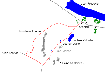
Meall nam Fuaran
By Colin Hogarth
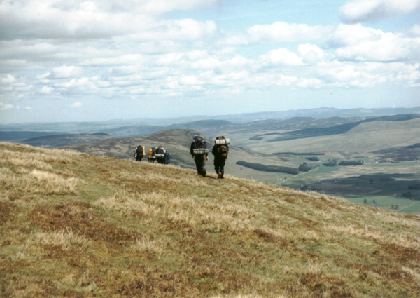
In the jumble of lumpy wee hills lying between Glen Almond and Glen Quaich, Meall nam Fuaran just cries out to be climbed. It is easily accessible from the road and a circuit can be created through Glen Lochan, passing below its craggy southern flank.
The track leaves the south-west side of the minor road - opposite the entrance to Glenquaich Lodge - and rises by a house a short way on where you pass through a wooden gate. The way climbs over open moor to reach a junction of tracks 500 metres from the start. Bear right here and continue the well graded ascent.
The route passes above ancient hut circles before rising to another junction. Go left at this point and the track crosses a stream before curving right, climbing more steeply now before terminating a short distance on. Continue to climb the broad eastern flank of the hill and views open out south across Glen Lochan and east over Strath Braan towards Dunkeld. Loch Freuchie below is also obvious.
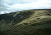
A cairn sitting above a brown quilt of peat hags marks the summit of Meall nam Fuaran. A few metres to the east, steep cliffs hang over Glen Lochan.
From the top, walk south-west across the peat hags to pick up an obvious track around 200 metres from the summit. This descends at a reasonable gradient initially before dropping more steeply through a series of curves into Glen Shervie below. When you reach a junction in the base of the valley, turn left and follow the track down. It runs parallel to the Glenshervie Burn where some very pleasant waterside picnic spots are to be found.
Lower down, just before the track crosses the burn at a bridge, look out for a path on the left which climbs between Meall nam Fuaran and Beinn na Gainimh into Glen Lochan. The way crosses a narrow bealach, steep slopes rising on both sides. It descends to a small pond before continuing through the base of the glen to tiny Lochan Uaine. From here it skirts the base of the slope to reach the much larger Lochan a'Mhuilinn.
Part way along the lochside, the path broadens into a good track which descends across the moor, taking you back down to the start of the route. It passes through a gate in a stone wall lower down, crosses a burn and leads past the junction of tracks encountered earlier in the day.
WALK FACTS
Distance 7.5 miles/12km.
Map OS Landranger sheet 52.
Start Track end opposite entrance to Glenquaich Lodge, two miles west of Amulree in Glen Quaich. GR: NN 863369.
Parking No parking at start but around 500 metres east along the road to Amulree there is a passing place with a wide grassy verge where cars can be parked without impeding the passing place.
Grading A straight forward route to the summit of a low hill with track and path for most of the way. Dogs must be under control due to sheep grazing. Avoid during the grouse shooting season (or go on a Sunday during this time).