Steele's Knowe
By Colin Hogarth
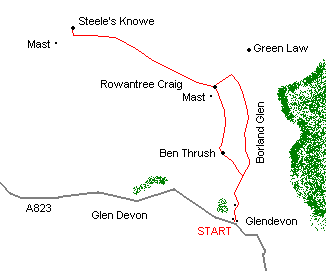
Steele's Knowe in the Ochil Hills offers an air of windswept remoteness. The summit is the highest point in a rolling swathe of low peaks rising to the east of Glen Eagles and to the north of Glen Devon. The ascent - via a right of way climbing through Borland Glen - is relatively easy and the views from the top stretch north to the much larger mountains of the Southern Highlands.
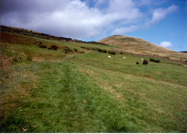
Leave the road and, following a 'Public Footpath for Auchterarder' sign post, head up a track that skirts below the youth hostel and leads to the Glenfoot cottage - a kennels and cattery. To the right of the house is an old metal gate with a rather faded wooden sign on it for Auchterarder. Go through the gate and follow a grassy track north across the open field. The route is rather marshy and reedy here which doesn't make for the easiest of walking - it's worth sticking to the more solid grass banks on either side.
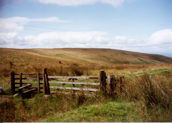
Continue up towards the top left hand corner of a stone wall and the way reaches a gate and stile. Cross the stile and head between two walls where there may be unlocked metal gates to negotiate. At the far end of this, a much more obvious, solid grass track leads up Borland Glen, between Ben Thrush to the left and the conical peak of White Creich Hill, on the right.
Follow the track up to its highest point, in the col to the west of Green Law where a gate is reached. Cross the fence here and bear left, following the fence up over the grassy slope to the top of Rowantree Craig, where there is a tall aerial mast.
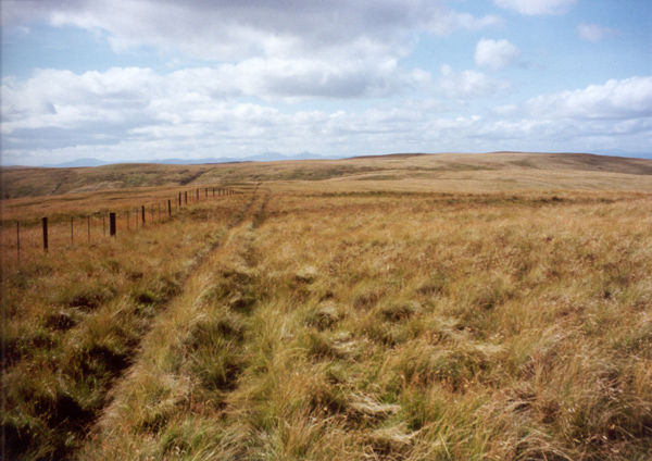
The line of the fence bears right at this point, as does the route. A grassy track heads west, following the fence over open moor. The way can be marshy in places.
Continue to follow the fence down into the shallow col between Rowantree Craig and Steele's Knowe (a fence must be crossed shortly before the low point is reached).
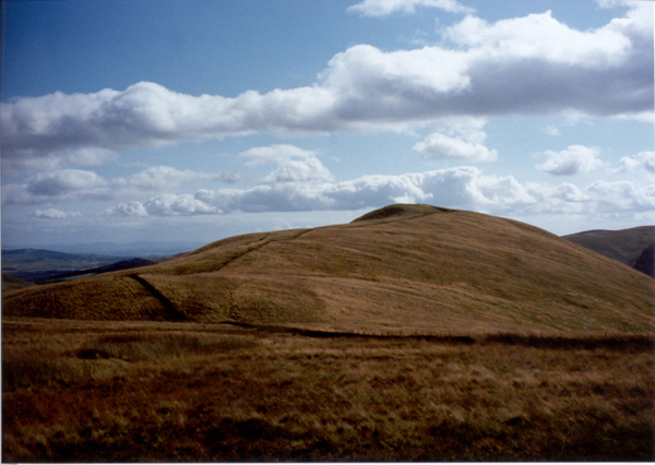
Stay with the fence for the gentle ascent of Steele's Knowe. Further on it is replaced by a stone dyke and, not far on, the grey concrete trig point marking the summit of the peak is spotted over to the right. Bear straight across the grass to reach this and enjoy fine views north over Auchterarder and Strathearn.
From the top of Steele's Knowe, return to the wall and follow the fence back towards the aerial mast on Rowantree Craig. Don't be tempted to take an obvious track that runs south from the trig point as it curves left down into the glen to the north of the hill.
Back below the mast, cross the fence followed up from the col below Green Law and walk to the left of the wall here, down into the col below and then up to the cairn marking the summit of Ben Thrush where views extend south-east towards Edinburgh and the Bass Rock, in the Forth estuary.
Descend east over open ground into Borland Glen. Stay to the left of a field below enclosed by stone walls. Take care as you descend as there is a small but steep section of crag part way down to avoid. Join the wall at the left hand end of the field and follow it down to meet the Borland Glen track taken earlier in the day. Retrace steps to the start.
WALK FACTS
Distance 6 miles/10km.
Map OS Landranger sheet 58.
Start Track end at Glendevon Youth Hostel on the A823 Auchterarder to Yetts o' Muckhart road as it enters the village of Glendevon (the 'Glendevon' sign is located right next to the start). Grid ref: NN 989046.
Parking There is a small parking area at the track end but don't block the gate or access to neighbouring house.
Grading A short walk to the summit of a low hill, climbing gently through Borland Glen and then crossing open moor. Stout, waterproof footwear is recommended as some sections can be marshy. There is extensive sheep grazing in Borland Glen where dogs will need to be on the leash.